Project Snapshot
Project overview
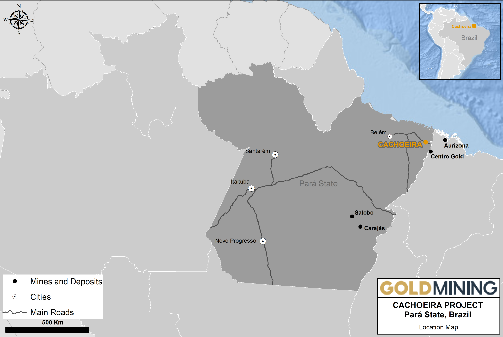
Cachoeira is a resource stage gold exploration project located on the coastal plain south of the estuary of the Amazon River in northeastern Brazil, approximately 250 km by road southeast of Belém, the capital city of Pará State. With a population of two million, Belém is a port located on the southern branch of the Amazon River delta, and has an international airport serviced by daily flights within Brazil and other parts of South America. The regional land package comprising of 2 mining concessions and 1 exploration permit totals 4,761 ha (47.6 km2).
The Cachoeira Project has indicated resources of 0.69 million gold ounces and inferred resources of 0.53 million gold equivalent ounces (see Resources). BHPꞌs (previously OZ Minerals) feasibility stage Centro Gold deposit occurs along the same major structural zone that hosts the Cachoeira deposit.
The Cachoeira project has had a long history of gold mining dating back to the 17th century with more recent exploration completed by Goldfields, Vale and Trek Mining (previously Luna Gold). Cachoeira greenstone hosted orogenic gold mineralization is hosted in three deposits that have been defined by drilling to 125 m depth on average - Tucano, Coruja, and Arara. Mining concessions cover the three deposits. In addition, the eastern margin of the greenstone belt has several coincident soil and geophysical anomalies that have not been tested by drilling.
Location
Gurupi Greenstone Belt in Pará State, Brazil
Property
Size 4,761 ha (47.61 sq km)
Ownership
100%
Commodity
Gold
Infrastructure
Paved highway, camp, water, nearby electrical power grid.
Deposit Type
Orogenic Gold
Location
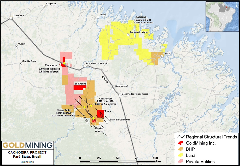
The Cachoeira Gold Project is located in the northeast of Pará State, Brazil, in the municipality of Cachoeira do Piriá. The Property is accessible from Belém along Federal Highway BR-316 which transects the south-central portion of the Property (see Figure 4.2). Driving time from Belém is approximately three hours.
The Project comprises 2 mining concessions and 1 exploration permit covering an aggregate area of approximately 4,761 ha (47.6 km2) in the Gurupi Gold Belt district of Pará. The claims are 100% owned by GoldMining INC.
Housing and core storage are in the urban area of Cachoeira do Piriá, with all-year access by paved highway, and access to water and nearby electrical grid.

Gurupi Greenstone Belt
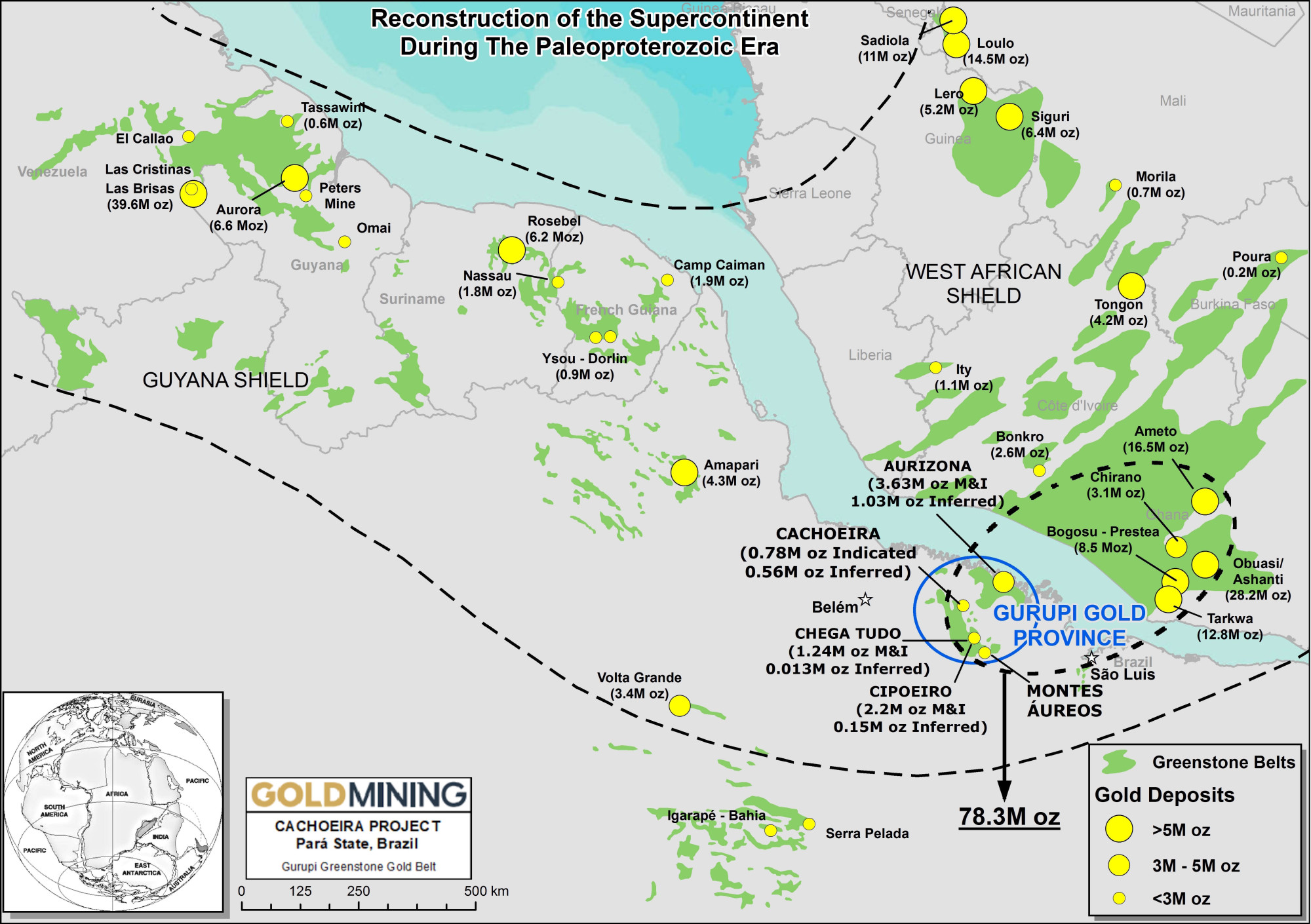
The Company’s 100% owned Cachoeira Project sits at the center of the Neoproterozoic Gurupi Greenstone Belt, which lies on the margin of the Sao Luis Craton. These terranes are correlated with the geologic terranes of similar age in West Africa.

Gurupi greenstone belt in relation to West Africa greenstone belts. Pre 120 million years ago geological reconstruction prior to formation of Atlantic Ocean.
The Property is located within the Tentugal Shear Zone that cuts the north-central portion of the Gurupi Belt and extends for over 120 km along strike and in places reaches 30 km in width. The Tentugal Shear Zone is a sinistral, transcurrent fault system with a subvertical plunge and hosts the majority of gold deposits and occurrences within the Gurupi Greenstone Belt.
Orogenic gold deposits account for a major percentage of global gold production and are abundant in many Archean and Proterozoic-Phanerozoic terranes. This deposit type tends to occur in clusters, forming gold “camps”. Global examples of these deposits include Chirano and Obuasi (Ghana), Rosebel (Suriname) Hollinger-McIntyre (Canada) and Golden Mile (Australia).

Geology and Mineralization
The Cachoeira property is underlain by an arcuate portion of the Tentugal Shear Zone that trends approximately north-south through the Project area and is informally termed the Cachoeira Shear Zone.
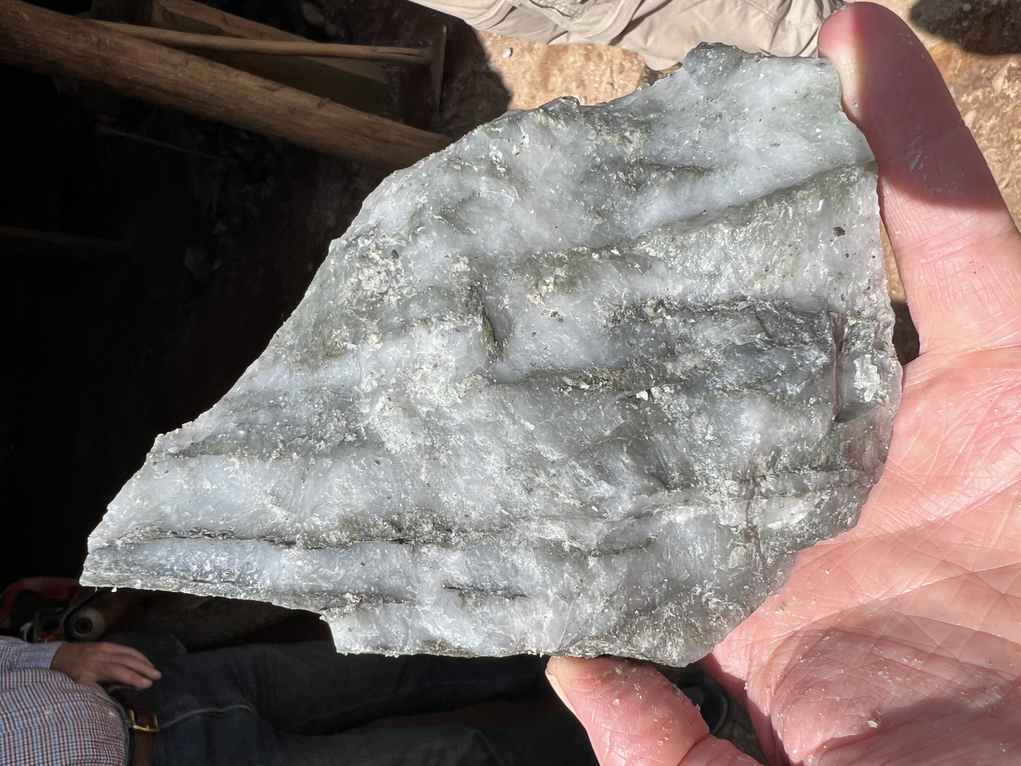
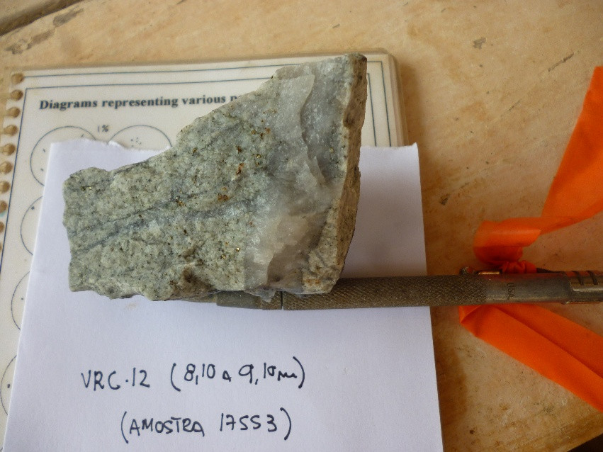
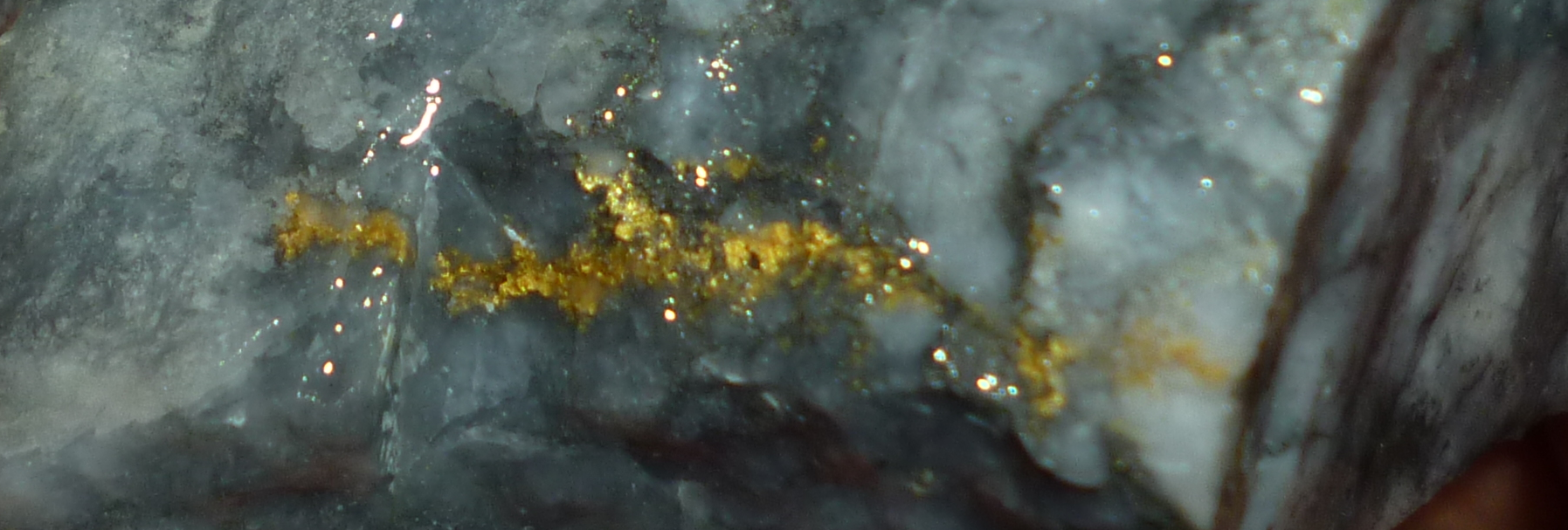
Gold mineralization occurs in quartz veins, sheeted veinlets and stockworks that occur preferentially within the volcano-sedimentary units.
Geologic units are orientated parallel to the main shear direction which trends north-northwest and dips westward at Tucano, north-south at Coruja, and swings to the north-northeast and dips eastward at Arara. The shear zone is contained within tuff and volcano-sedimentary rocks that are juxtaposed against intermediate and mafic volcanics.
Gold Mineralization
Three zones of mineralization have been identified within the Property. These are Tucano, Coruja and Arara and occur along a strike interval of about 4 kilometres.
Gold occurs in quartz veins, veinlets and stockworks as well as within the albite-quartz-sulphide alteration envelope that surrounds the veins and shear zones. Gold grades are generally proportional to the abundance of quartz veining. There are two main types of quartz veins; white-grey and smoky quartz which are typically brecciated and exhibit several generations of fracturing and re-healing and local breccia textures proximal to faults. Quartz veins are discontinuous although the shear zones within which they occur are persistent over hundreds of meters.
Activities:
- Historic drilling completed: 773 holes (37,099 m)
- Established resources include 691,676 oz gold Indicated at 0.35 g/t gold cut-off & 537,756 oz gold Inferred at 0.35 g/t gold cut-off
- Extensive trench and bulk sampling (samples ranging from 700 to 1000kg) program confirms the projection of the mineralized zones at Arara to surface
Resource Statement
| Deposit | Cut-off | Tonnes | Grade | Contained Metal | ||||||
| Gold | Silver | Copper | Gold Eq | Gold | Silver | Copper | Gold Eq | |||
| (g/t) | (Mt) | (g/t) | (g/t) | (%) | (g/t) | (Moz) | (Moz) | (Mlbs) | (Moz) | |
| Indicated Resources | ||||||||||
| Cachoeira | 0.35 | 17.47 | 1.23 | -- | -- | 1.23 | 0.69 | -- | -- | 0.69 |
| Inferred Resources | ||||||||||
| Cachoeira | 0.35 | 15.67 | 1.07 | -- | -- | 1.07 | 0.54 | -- | -- | 0.54 |
Notes to Resources:
1. Mineral resources are not mineral reserves and do not have demonstrated economic viability. There is no certainty that all or any part of the mineral resources will be converted into mineral reserves.
2. Numbers may not add due to rounding.
3. Based on technical report titled "Technical Report and Resource Estimate on the Cachoeira Property, Pará State, Brazil" with an effective date of April 17, 2013, and amended and re-stated October 2, 2013, which is available at http://www.sedar.com under GoldMining's SEDAR profile.
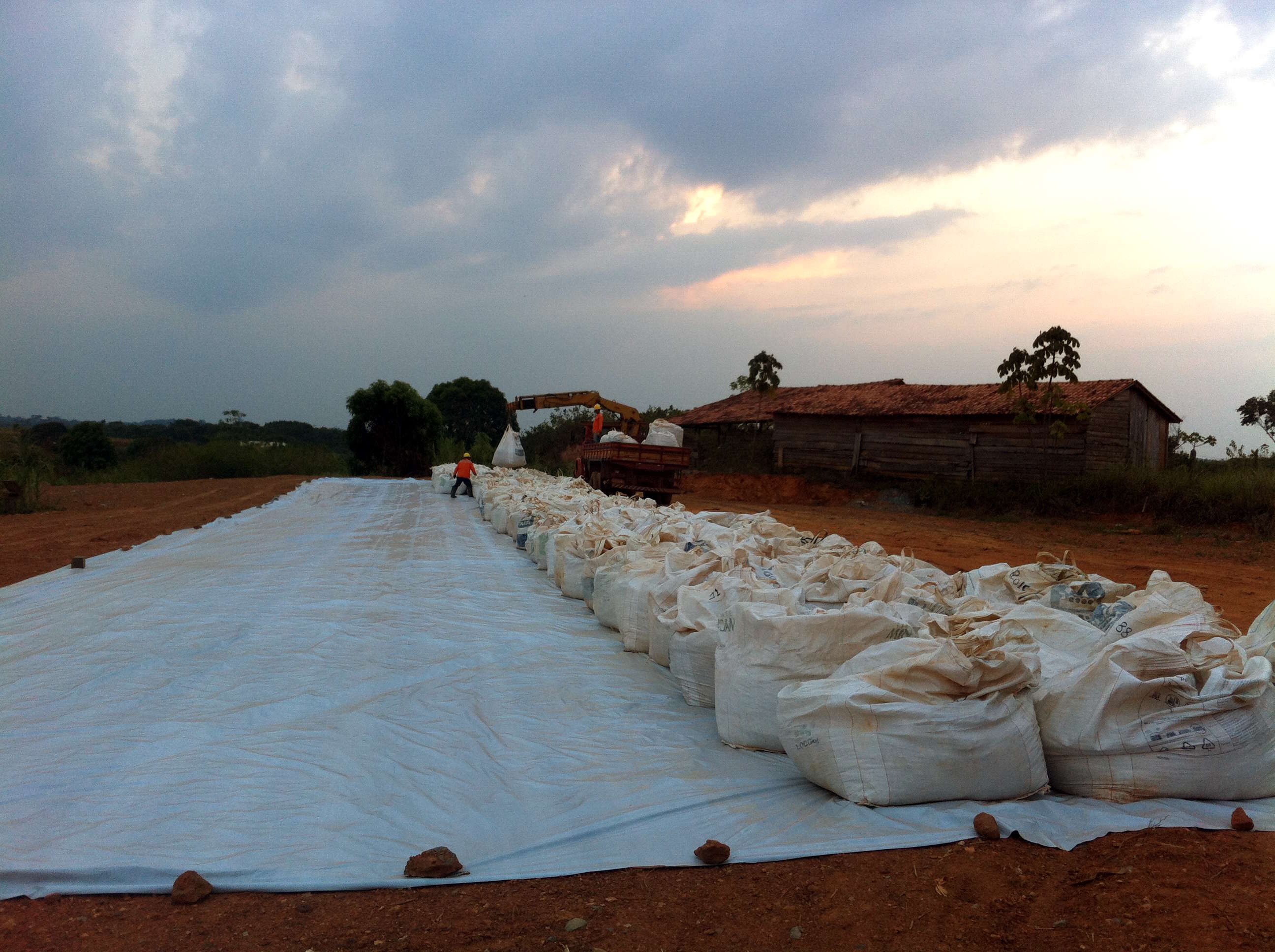
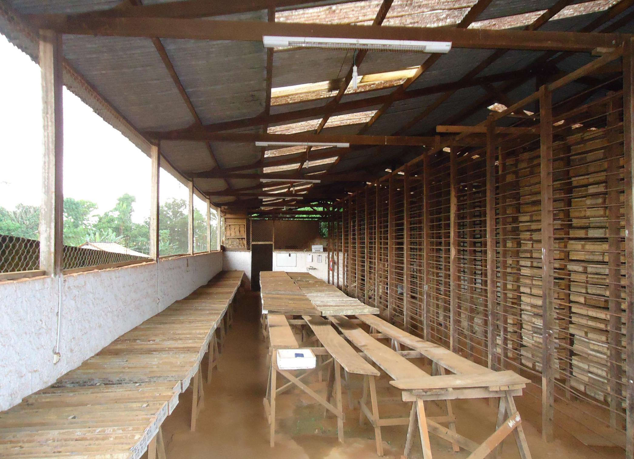
Cachoeira - Gallery