Project Snapshot
Overview
The Rea uranium project is owned by GoldMining (75%) and Orano Canada Inc (25%). The large land package is comprised of 16 permits covering an area of approximately 125,000 hectares (308,882 acres) and surrounds Oranoꞌs high-grade Maybelle River uranium project. Other uranium occurrences in the district include include Fission Uraniumꞌs ‘Triple R’ and NexGenꞌs ‘Arrow’ deposit located approximately 100 km to the east of Maybelle.
Location
Western Athabasca Basin, Alberta, Canada
Property Size
125,000 hectares
Ownership
75%
Commodity
Uranium
Infrastructure
Winter Road
Deposit Type
Unconformity –type uranium
Location
The Rea Property is located 175 km northeast of Fort McMurray in northeastern Alberta, Canada. The center of the property is approximately 30 km east of the Alberta-Saskatchewan border and 42 km south of Lake Athabasca. The Property is accessible year-round by fixed wing float or ski equipped aircraft and helicopter from Fort McMurray or by a winter road that connects Fort McKay and Fort Chipewyan.
Rea lies in the western Athabasca Basin which is home to some of the highest-grade uranium mines globally, yet remains relatively underexplored in the western part of the basin that falls within the province of Alberta.
Figure 1: Rea Property location map.
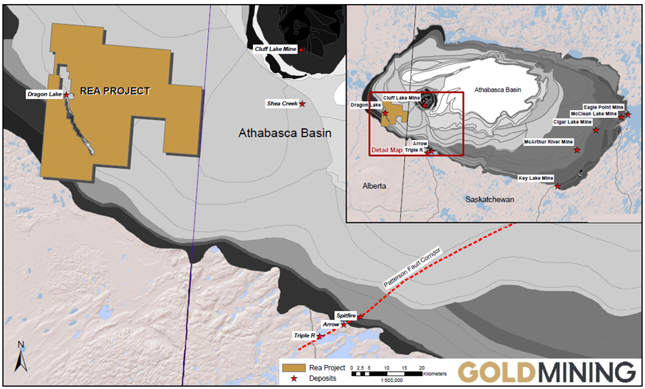
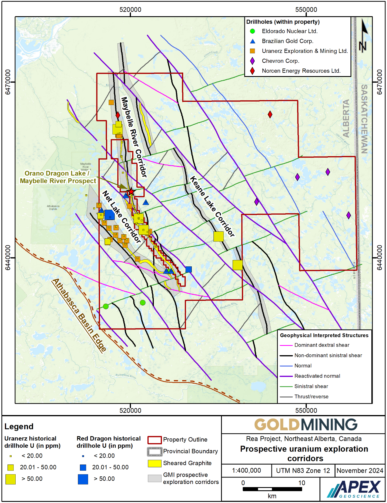
Figure 2: Rea Project, prospective exploration corridors
Geology and Mineralization
The Athabasca Basin is a Proterozoic-aged sedimentary sequence, which overlies unconformably the Archean Rae Province in the west and the Archean Hearne Province in the east. It is the world's foremost host of high-grade unconformity-type uranium deposits and currently produces approximately 15 % of the World's supply of uranium, as of 2022.
The Rea Property is located within the western margin of the Athabasca Basin in which the target is uranium mineralization hosted at or near the unconformity between the Archean crystalline basement and the Proterozoic Athabasca Group. Uranium mineralization has been identified within the Maybelle Property, owned 100% by Orano, which the Rea Property surrounds. Specifically, the ‘Dragon Lake’ target has returned high-grade historic drill intercepts of up to 17.7% U3O8 over 5 meters drill width. Within the Rea Property, several historic drill holes have intersected alteration and breccia zones with anomalous concentrations of uranium and associated pathfinder elements, key features associated with unconformity-type uranium deposits.
Proterozoic unconformity-type uranium deposits host greater than 30% of the world’s known uranium resources. Unconformity-type uranium deposits of the Athabasca Basin are characterized by elongate, pod shaped uranium mineralization at the unconformity between the overlying Proterozoic sedimentary rocks and favourable underlying Archean graphitic basement rocks.
The Company is presently conducting stakeholder engagement activities and planning to undertake a ground geophysics program targeting the Maybelle River Trend.
Figure 2: Rea Property geophysics map showing historic uranium exploration and interpreted trend of prospective EM Conductors along strike of the Maybelle River.
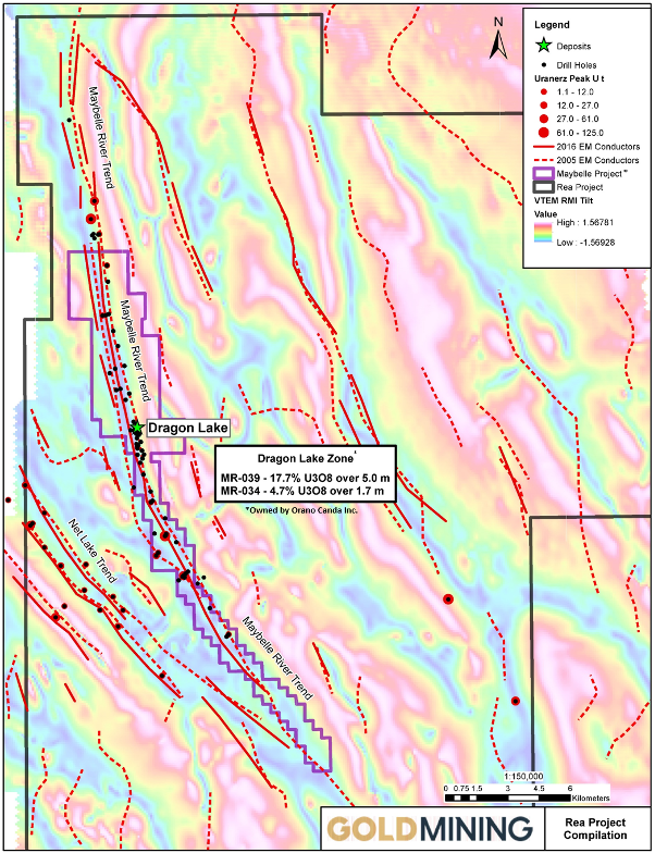
Figure 3: Schematic Athabasca –style geology and uranium mineralization.

Activities:
- Stakeholder engagement and permitting
- Planning for a detailed geophysical survey to generate drill targets on the Maybelle River Trend